
DigiPIN vs PIN Code: Key Differences and Why It Matters
Published on July 24, 2026
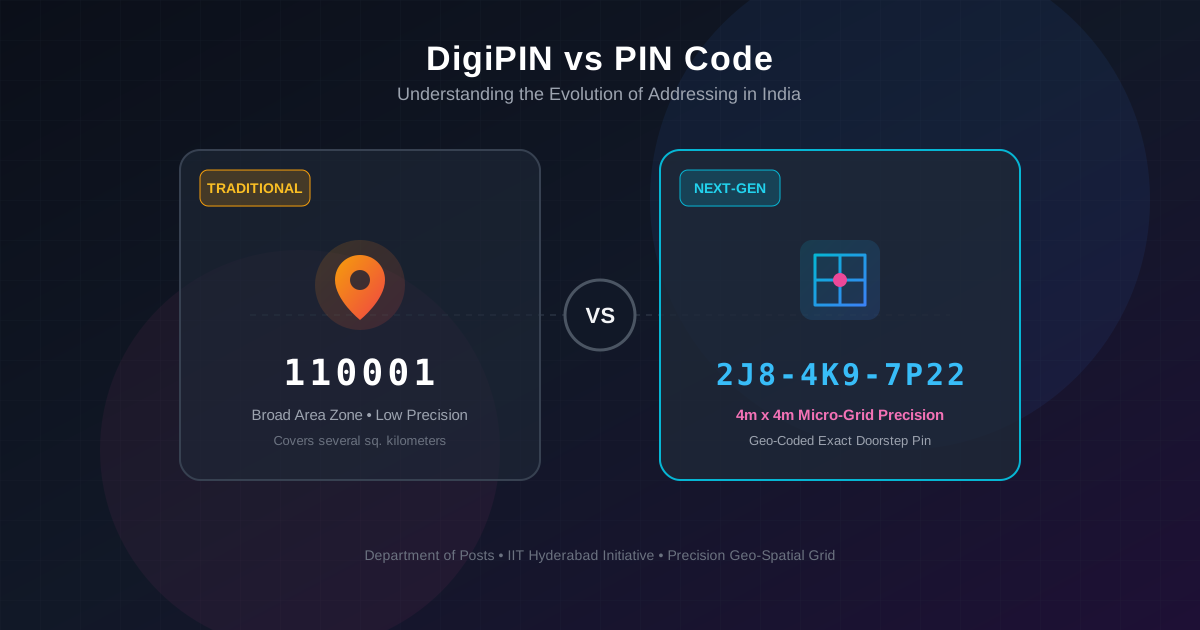
Quick Answer: Traditional PIN Codes divide India into large geographic delivery regions using 6 digits, while DigiPIN is an advanced 10-digit alphanumeric geo-coded grid system that identifies specific 4m x 4m physical locations. DigiPIN eliminates landmark dependency, enabling pinpoint accuracy for e-commerce, emergency services, and national infrastructure.
For over five decades, the six-digit Postal Index Number (PIN) code has been the backbone of mail sorting and parcel delivery across India. Introduced by the Department of Posts in 1972, this system brought order to a massive, sprawling nation. However, as e-commerce exploded, emergency services modernized, and drone delivery moved from sci-fi fantasy to technical reality, the limitations of traditional PIN codes became glaringly obvious.
Enter DigiPIN (Digital Postal Index Number)—a groundbreaking national addressing initiative developed by the Department of Posts in collaboration with IIT Hyderabad.
Whether you are an everyday citizen tired of directing delivery drivers over the phone or a logistics executive aiming to optimize supply chain efficiency, understanding the fundamental differences between the traditional PIN code and DigiPIN is vital.
What is the Traditional PIN Code System?
The traditional Postal Index Number (PIN Code) is a 6-digit numerical code used by India Post to simplify manual and automated mail sorting.
How it Works:
- First Digit: Represents one of the 9 postal regions in India (8 geographical zones plus 1 functional zone for the Indian Army).
- Second Digit: Indicates the sub-region or postal circle.
- Third Digit: Specifies the sorting or revenue district within that region.
- Last Three Digits: Identify the specific local post office responsible for final delivery.
The Limitation of PIN Codes
While revolutionary in 1972, a single traditional PIN code covers a broad geographic expanse—sometimes encompassing dozens of square kilometers, hundreds of apartment complexes, or several rural villages.
Because a traditional PIN code only points to a central postal hub rather than an exact doorstep, last-mile delivery drivers must rely heavily on ambiguous text addresses, local landmarks (“behind the old water tank”), and frequent phone calls to locate recipients.
What is DigiPIN?
DigiPIN is a modern, open-source, digital geospatial addressing grid system. Instead of grouping neighborhoods under a single post office code, DigiPIN divides the entire landmass and territorial waters of India into a uniform grid of tiny 4-meter by 4-meter (4m x 4m) spatial units.
Every single 4m x 4m square across India is assigned a unique, 10-character alphanumeric code derived directly from its exact latitude and longitude coordinates.
Key Features of DigiPIN:
- Micro-Grid Precision: Pinpoints locations down to a 4m x 4m box—small enough to identify a specific front gate, loading dock, or rural farm entrance.
- Offline Computability: The mathematical algorithm converting latitude/longitude to DigiPIN (and vice versa) works entirely offline, requiring no centralized database lookup.
- Privacy by Design: DigiPIN represents spatial coordinates, not personal identity or private ownership data.
- Hierarchy & Scalability: Digits in a DigiPIN code progressively narrow down spatial bounding boxes, making spatial query processing extremely efficient.
DigiPIN vs PIN Code: Head-to-Head Comparison
To understand why this shift is happening, let us compare both systems across key operational parameters:
| Feature | Traditional PIN Code | Modern DigiPIN |
|---|---|---|
| Code Length & Format | 6 Digits (Numeric) | 10 Characters (Alphanumeric) |
| Spatial Precision | Broad regional area (sq km) | Micro-location (4m x 4m grid) |
| Primary Basis | Post office administrative boundaries | Exact latitude and longitude coordinates |
| Landmark Reliance | High (requires text addresses & phone calls) | Zero (direct coordinate mapping) |
| Creation Basis | Human-assigned administrative zones | Algorithmic spatial partitioning |
| Automation & Robotics | Limited to mail hub sorting | Fully compatible with autonomous delivery & drones |
| Privacy Protection | Tied to postal regions and street names | Neutral geospatial coordinates with no personal data |
Why the Transition to DigiPIN Matters
The movement from regional postal codes to granular digital grid codes is not just an incremental update; it is a structural upgrade for India’s digital economy.
1. Eliminating Last-Mile Inefficiencies in Supply Chains
Last-mile delivery accounts for up to 53% of total logistics costs. Misrouted drivers, incomplete addresses, and repeated delivery attempts cost courier companies millions annually.
By integrating DigiPIN into dispatch engines, fleet management systems can direct drivers directly to the loading bay or apartment gate. Supply chain managers looking to streamline operations can learn how companies cut down delivery re-attempts and slash last-mile operational expenses through precision spatial addressing.
2. Lifesaving Precision for Emergency Services
When seconds count during medical crises, fires, or natural disasters, traditional addresses cause critical delays. An ambulance navigating with a traditional address might lose precious minutes searching for an unmarked house down a winding alley. With DigiPIN, emergency response teams receive exact sub-meter coordinates, ensuring rapid dispatch directly to the victim.
3. Boosting E-Commerce in Rural and Semi-Urban Areas
In rural India, formal house numbering systems often do not exist. E-commerce platforms frequently fail to deliver parcels to tier-3 and tier-4 regions due to non-standardized addresses. DigiPIN provides every farm, field, and rural home with a standardized digital identity, unlocking e-commerce access for hundreds of millions of citizens.
4. Supporting Future Autonomous Delivery Technologies
Autonomous delivery vehicles and delivery drones cannot read physical signs like “opposite the yellow building.” They require structured, machine-readable geospatial points. DigiPIN provides the exact mathematical grid structure required to guide autonomous systems safely from warehouse to doorstep.
How DigiPIN and PIN Codes Will Coexist
It is important to note that DigiPIN is not designed to immediately erase or replace the traditional 6-digit PIN code. Instead, both systems will work in tandem:
- Traditional PIN Codes will continue to act as macro-level identifiers for long-haul routing, national mail sorting hubs, and regional regional allocation.
- DigiPIN will serve as the micro-level layer for final-mile navigation, spatial mapping, emergency response, and localized services.
Think of the traditional PIN code as the city or neighborhood name on a map, and DigiPIN as the exact pin dropped on your GPS screen.
Conclusion: Preparing for the Geospatial Future
The introduction of DigiPIN marks a major leap forward in national infrastructure. By transforming addresses from ambiguous text descriptions into precise, 4m x 4m digital coordinates, India is setting a worldwide precedent for geospatial addressing.
For everyday citizens, DigiPIN means faster deliveries and fewer hassle calls from couriers. For logistics firms, government agencies, and tech developers, adopting DigiPIN tools today opens up massive opportunities for operational savings and customer satisfaction.
Start exploring DigiPIN tools and spatial APIs now to ensure your platform is ready for the future of digital addressing.