
DigiPIN Code Structure: How India's Grid System Works
Published on August 16, 2026
Quick Answer: DigiPIN is an indigenous, open-source 10-character alphanumeric digital addressing system that divides India into hierarchical 4m x 4m geographical grid cells. Developed by India Post and IIT Hyderabad, it uses recursive spatial partitioning to convert precise latitude and longitude coordinates into an offline-computable, privacy-preserving location code.
For decades, India has relied on the six-digit Postal Index Number (PIN) code introduced in 1972. While traditional PIN codes effectively route mail to local post offices, they were never designed to pinpoint a specific doorstep, apartment entrance, or warehouse loading dock. In rapid e-commerce expansion and dense urban landscapes, descriptive directions—like “opposite the water tank, behind the blue gate”—lead to substantial delivery friction.
To solve this challenge, the Department of Posts (DoP) collaborated with the Indian Institute of Technology (IIT) Hyderabad to build DigiPIN (Digital Postal Index Number). DigiPIN is a sovereign, open-source, grid-based addressing standard engineered to establish a uniform digital address ecosystem for India.
In this deep dive, we examine the inner workings of the DigiPIN code structure, the mathematical partitioning behind its grid architecture, and how it translates geospatial coordinates into actionable micro-addresses.
1. What is DigiPIN? The Fundamental Concept
DigiPIN is an alphanumeric geocoding system designed specifically for the sovereign territory and maritime Exclusive Economic Zone (EEZ) of India. Rather than assigning arbitrary sequential numbers to buildings, DigiPIN divides the entire landmass into a nested series of hierarchical bounding boxes.
At its highest resolution (Level 10), DigiPIN represents an ultra-precise 4-metre by 4-metre (approx. 16 sq. metres) micro-grid cell.
+-------------------------------------------------------------+
|                     INDIA BOUNDING BOX                      |
|  +-----------------------+  +----------------------------+  |
|  | Level 1: Macro Region |  | Level 2: Sub-Region        |  |
|  +-----------------------+  +----------------------------+  |
|               ... down to ...                               |
|  +-------------------------------------------------------+  |
|  | Level 10: Precise Doorstep Unit (4m x 4m Resolution)  |  |
|  +-------------------------------------------------------+  |
+-------------------------------------------------------------+
Key Architectural Pillars
- Completely Offline: Conversion between geographic coordinates (Latitude/Longitude) and DigiPIN requires zero internet connectivity or proprietary API lookups.
- Mathematical Continuity: Nearby spatial areas share common prefix strings, preserving geospatial proximity relationships.
- Public Domain Standard: Developed without proprietary licensing restrictions, enabling direct adoption across government departments, private couriers, and open-source mapping stacks.
2. Anatomy of the DigiPIN Code Structure
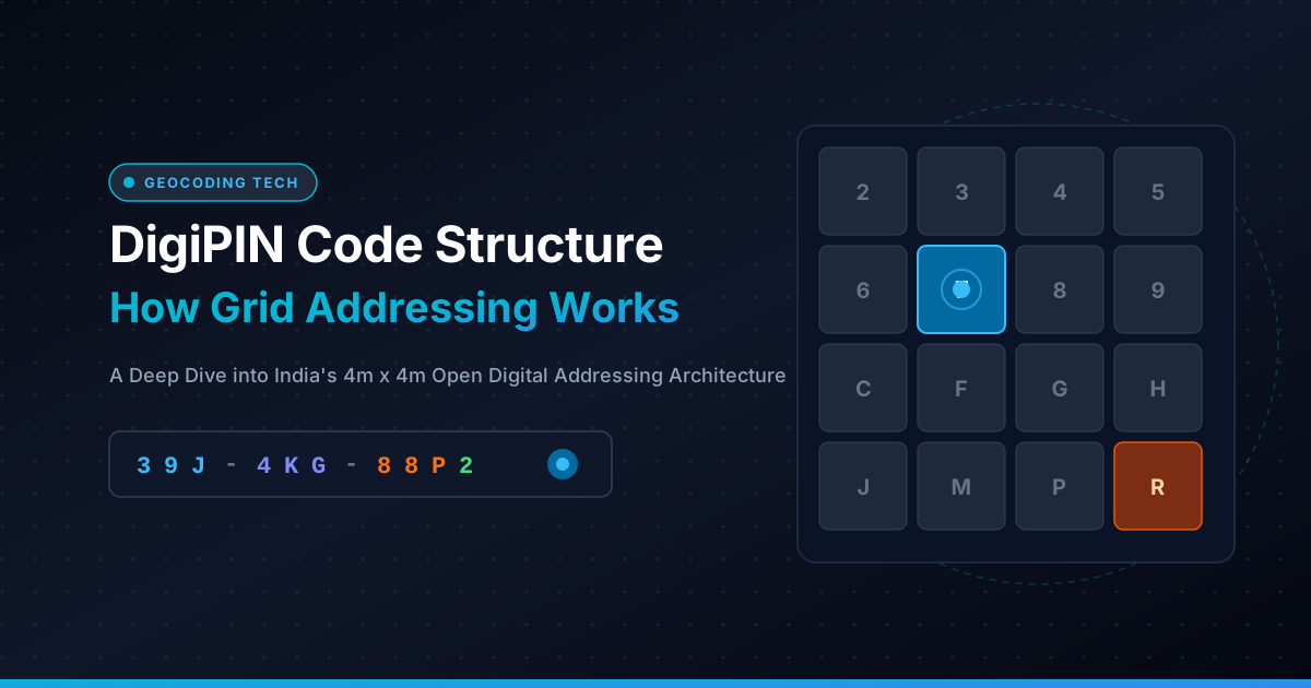
A standard DigiPIN code consists of 10 alphanumeric characters, often formatted with hyphens for visual clarity (e.g., 234-567-89CF or 39J-4KG-88P2). Each character represents a specific nested partition level within India’s spatial envelope.
       3 9 J - 4 K G - 8 8 P 2
       │ │ │   │ │ │   │ │ │ └─ Level 10 (~4m x 4m micro-cell)
       │ │ │   │ │ │   │ │ └─── Level 9  (~16m x 16m block)
       │ │ │   │ │ │   │ └───── Level 8  (~65m x 65m parcel)
       │ │ │   │ │ │   └─────── Level 7  (~260m x 260m cluster)
       │ │ │   │ │ └─────────── Level 6  (~1km x 1km neighborhood)
       │ │ │   │ └───────────── Level 5  (~4km x 4km sector)
       │ │ │   └─────────────── Level 4  (~16km x 16km sub-district)
       │ │ └─────────────────── Level 3  (~65km x 65km district)
       │ └───────────────────── Level 2  (~260km x 260km state zone)
       └─────────────────────── Level 1  (~1000km x 1000km primary zone)
The 16-Character Alphanumeric Base
Human error is the primary vulnerability in digital address transmission. Reading codes over the phone or transcribing them by hand often causes character confusion. DigiPIN solves this by utilizing a Base-16 (hexadecimal-like) customized alphanumeric alphabet that deliberately excludes visually or phonetically ambiguous characters.
| Allowed Characters | Excluded Characters | Reason for Exclusion |
|---|---|---|
2, 3, 4, 5, 6, 7, 8, 9 |
0, 1 |
Avoids confusion with letters O, I, and L |
C, F, G, H, J, M, P, R |
A, B, D, E, K, L, N, O, S, T, U, V, W, X, Y, Z |
Eliminates homoglyphs and potential unintended word formation |
Because every character slot draws from an exact 16-symbol radix ($4 \times 4$ spatial matrix), each successive character divides a parent grid cell into exactly 16 equal child sub-cells (a $4 \times 4$ sub-grid).
3. How Recursive Grid Partitioning Works
To understand how DigiPIN encodes a location, imagine India bounded inside a macro-geographical coordinate rectangle spanning its territorial boundaries and maritime EEZ.
+---+---+---+---+
| 2 | 3 | 4 | 5 |
+---+---+---+---+
| 6 | 7 | 8 | 9 |
+---+---+---+---+
| C | F | G | H |
+---+---+---+---+
| J | M | P | R |
+---+---+---+---+
 Figure 1: The 4x4 matrix mapping 16 discrete sub-cells per tier.
The Step-by-Step Recursive Process:
- Bounding Box Definition: The coordinate space of India is mapped within defined minimum and maximum latitudes and longitudes ($Lat_{min}, Lat_{max}, Lon_{min}, Lon_{max}$).
- First-Level Division (Level 1): The entire country-level bounding box is divided into 16 quadrants (4 rows $\times$ 4 columns). The target latitude and longitude fall into one of these blocks, which yields the 1st character.
- Sub-Division Iterations (Levels 2 through 9): That selected cell is treated as a new bounding box and recursively split into another $4 \times 4$ matrix. The location’s relative coordinates determine the subsequent characters.
- Target Precision (Level 10): At the 10th iteration, the bounding box shrinks to approximately $4\text{m} \times 4\text{m}$, providing the final character of the address string.
This quadtree-style spatial subdivision guarantees that two addresses that share the first 6 characters belong to the same 1-square-kilometre neighborhood, facilitating regional routing before last-mile resolution.
4. Mathematical Comparison: Resolution Levels
The following table demonstrates how spatial resolution tightens as each character is appended to a DigiPIN code:
| Hierarchy Level | String Length | Nominal Dimension (Approx.) | Practical Real-World Representation |
|---|---|---|---|
| Level 1 | 1 Char | $\sim 1000 \text{ km} \times 1000 \text{ km}$ | Major National Zone (North, South, etc.) |
| Level 2 | 2 Chars | $\sim 250 \text{ km} \times 250 \text{ km}$ | Regional State Cluster |
| Level 3 | 3 Chars | $\sim 65 \text{ km} \times 65 \text{ km}$ | Metropolitan Region / District |
| Level 4 | 4 Chars | $\sim 16 \text{ km} \times 16 \text{ km}$ | Urban Municipality / Taluka |
| Level 5 | 5 Chars | $\sim 4 \text{ km} \times 4 \text{ km}$ | City Sector or Suburb |
| Level 6 | 6 Chars | $\sim 1 \text{ km} \times 1 \text{ km}$ | Neighborhood / Postal Delivery Beat |
| Level 7 | 7 Chars | $\sim 250 \text{ m} \times 250 \text{ m}$ | City Block / Large Industrial Complex |
| Level 8 | 8 Chars | $\sim 65 \text{ m} \times 65 \text{ m}$ | Housing Society / Commercial Campus |
| Level 9 | 9 Chars | $\sim 16 \text{ m} \times 16 \text{ m}$ | Specific Building Footprint |
| Level 10 | 10 Chars | $\sim 4 \text{ m} \times 4 \text{ m}$ | Individual Doorstep / Gate / Dock |
5. DigiPIN vs. Alternative Addressing Schemes
To appreciate the engineering decisions behind DigiPIN, it helps to compare it against existing proprietary and open addressing mechanisms:
+-------------------+-----------------+-------------------+-------------------+
| Feature           | DigiPIN         | what3words        | Google Plus Codes |
+-------------------+-----------------+-------------------+-------------------+
| Architecture      | 4x4 Grid Matrix | 3-Word Dictionary | Base-20 Open Location|
| Governance        | India Post / IIT| Private Company   | Google LLC        |
| Offline Parsing   | Fully Native    | Proprietary Table | Open-Source       |
| Resolution        | 4m x 4m         | 3m x 3m           | ~3m x 3m (11-char)|
| Character Ambiguity| Ultra-Low (16ch)| Language-Dependent| Moderate (20 char)|
| Sovereignty       | 100% Indian IP  | UK Licensed       | Global Standard   |
+-------------------+-----------------+-------------------+-------------------+
While systems like what3words require proprietary dictionary databases that are difficult to embed into lightweight edge microcontrollers, DigiPIN utilizes pure geometric calculation. Developers can compute DigiPIN addresses using straightforward mathematical formulas without external network requests.
6. Practical Industry Applications
                  DIGIPIN OPERATIONAL APPLICATIONS
                                  │
    ┌─────────────────────────────┼─────────────────────────────┐
    ▼                             ▼                             ▼
+─────────────────+     +─────────────────+     +─────────────────+
|   E-COMMERCE &  |     |    EMERGENCY    |     | URBAN PLANNING  |
|    LOGISTICS    |     |    SERVICES     |     |  & PROPERTY     |
| Last-mile drops |     | Ambulance/Fire  |     | Geo-tagging &   |
| Zero misroutes  |     | Sub-minute sync |     | Infrastructure  |
+─────────────────+     +─────────────────+     +─────────────────+
1. E-Commerce and Courier Logistics
For logistics networks, inaccurate addresses cause higher RTO (Return to Origin) rates, missed delivery windows, and excess fuel consumption. By streamlining last-mile operations and eliminating address ambiguity, carriers can route vehicles directly to the exact drop-off coordinate without relying on multiple phone calls between dispatchers, drivers, and customers.
2. Emergency Response Systems (ERSS - 112)
During life-critical emergencies, pinpointing an incident location in informal settlements or unstructured rural terrain is vital. A 10-digit DigiPIN transmitted over SMS or automated distress signals allows ambulances and disaster response teams to navigate directly to the scene without navigation bottlenecks.
3. Municipal Governance & Asset Tagging
Smart cities can utilize DigiPIN as a spatial foreign key across civic databases. Utility meters, streetlamps, pipeline valves, and property tax records can be bound directly to their DigiPIN coordinate, simplifying infrastructure tracking across agencies.
7. The Future: Integrating DigiPIN into Digital Public Infrastructure
DigiPIN is designed to become a core layer of India’s Digital Public Infrastructure (DPI), integrating alongside platforms like Aadhaar, UPI, and ONDC (Open Network for Digital Commerce).
As drone delivery corridors, autonomous ground logistics, and hyper-local delivery services expand, human-readable prose addresses will increasingly give way to deterministic grid coordinates. DigiPIN provides the necessary bridge—compact enough for human communication while remaining computationally precise for automated systems.
Summary Checklist: Why DigiPIN Matters
- Precision: Down to a 4m $\times$ 4m bounding box anywhere in India.
- Resilience: Completely functional offline without server dependencies.
- Safety: Zero phonetically or visually ambiguous characters.
- Integration: Open architecture ready for e-commerce, emergency systems, and national logistics workflows.