
A Deep Dive into DigiPIN Code Structure & Grid Addressing
Published on August 5, 2026
Quick Answer: DigiPIN (Digital Postal Index Number) is India’s open-source, grid-based geo-addressing system developed by India Post and IIT Hyderabad. It divides the entire nation into a hierarchical matrix down to 4m x 4m units, encoding precise latitude and longitude coordinates into a 10-character alphanumeric string for exact location identification.
Navigating addresses in India has historically presented unique logistical challenges. From unnumbered doorsteps in dense urban pockets to vast rural expanses lacking formal street names, traditional 6-digit PIN codes—first introduced in 1972—cover broad regional zones rather than specific physical points.
Enter DigiPIN (Digital Postal Index Number): a revolutionary, open-standard, National Geo-Addressing Grid framework spearheaded by the Department of Posts (India Post) in collaboration with IIT Hyderabad. By shifting from area-based postal codes to precise, spatial grid-based coordinates, DigiPIN promises to redefine e-commerce deliveries, emergency service response, and governance across the subcontinent.
In this technical deep dive, we will unpack the mathematical and spatial structure of the DigiPIN code, explain how grid-based addressing operates, and explore why this digital infrastructure is a game-changer for courier companies, government agencies, tech developers, and citizens alike.
What is DigiPIN and Why Does India Need It?
Traditional 6-digit PIN codes were built for manual sorting centers. A single PIN code often spans tens of square kilometers, encapsulating thousands of households, commercial buildings, and open fields. For last-mile delivery drivers and emergency response teams, arriving in the correct PIN code area is only 20% of the journey; finding the exact building entrance makes up the remaining 80%.
DigiPIN solves this fundamental limitation by establishing a uniform, mathematically computed geo-spatial grid over the entire geographical extent of India, including its territorial waters.
To understand how this modern innovation contrasts with legacy infrastructure, explore our detailed breakdown on DigiPIN vs PIN Code: Key Differences and Why It Matters.
+-----------------------------------------------------------------------+
|                         TRADITIONAL PIN CODE                          |
|  - Covers large broad regions (e.g., 110001 = New Delhi Central)     |
|  - Requires complex street addresses and landmarks                   |
|  - High delivery failure rate in last-mile operations                 |
+-----------------------------------------------------------------------+
                                   vs
+-----------------------------------------------------------------------+
|                            INDIAN DIGIPIN                             |
|  - 10-character alphanumeric code linked to exact Lat/Long            |
|  - Pinpoints a micro-grid unit of approx. 4 meters x 4 meters         |
|  - Fully digital, offline-calculable, privacy-preserving              |
+-----------------------------------------------------------------------+
The Core Mechanics: How Grid-Based Addressing Works
Grid-based addressing replaces descriptive textual addresses (“Opposite Big Banyan Tree, behind Old Water Tank”) with spatial partitioning. Instead of naming streets, the map of India is rendered as an interconnected lattice of tiny squares.
1. Spatial Partitioning and Boundary Definition
The DigiPIN system defines an overarching bounding box covering the entire country—extending roughly from Latitude 6° N to 38.5° N and Longitude 68° E to 98.5° E. This master rectangle encompasses India’s mainland, island territories (Andaman & Nicobar, Lakshadweep), and exclusive maritime economic zones.
2. Hierarchical Recursive Subdivision
The grid operates on a 10-level recursive breakdown.
- The entire map of India is initially partitioned into a 4x4 grid (16 primary regions).
- Each primary region is further subdivided into a 4x4 grid (16 secondary sub-regions).
- This recursive division continues down through 10 distinct levels.
At Level 1, a single cell represents hundreds of kilometers. By the time you reach Level 10, the grid cell measures approximately 3.8 meters by 3.8 meters (roughly 4m x 4m). This pinpoint size is ideal for identifying individual doorways, utility poles, farm gates, or delivery drop-off zones.
Breaking Down the 10-Character DigiPIN Structure
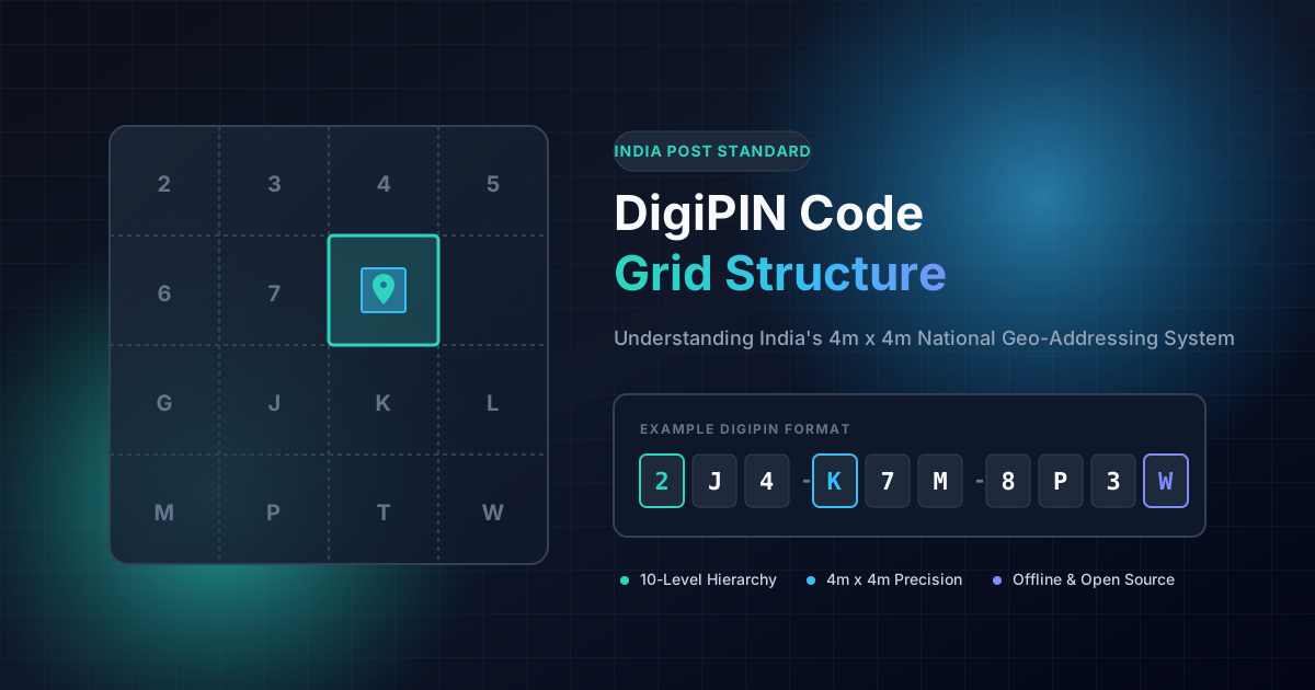
A complete DigiPIN consists of 10 alphanumeric characters (often presented in a formatted structure such as 2J4-K7M-8P3W for readability).
Unlike random unique identifiers stored in a central server, every character in a DigiPIN directly corresponds to a specific spatial quadrant at that level of hierarchy.
DigiPIN Example:  2  J  4  K  7  M  8  P  3  W
                 |  |  |  |  |  |  |  |  |  |
Level:           1  2  3  4  5  6  7  8  9  10
Precision:    [Macro Region] ---------> [4m x 4m Exact Box]
The 16-Character Symbol Set
To avoid human errors—such as mistaking the number 0 for the letter O, or 1 for I—DigiPIN deliberately excludes confusing characters. It utilizes a custom Base-16 alphanumeric alphabet:
$$\text{DigiPIN Alphabet} = { 2, 3, 4, 5, 6, 7, 8, 9, G, J, K, L, M, P, T, W }$$
Each character maps directly to one of 16 sub-cells in a 4x4 matrix grid layout:
| Row / Col | Col 0 | Col 1 | Col 2 | Col 3 |
|---|---|---|---|---|
| Row 0 | 2 | 3 | 4 | 5 |
| Row 1 | 6 | 7 | 8 | 9 |
| Row 2 | G | J | K | L |
| Row 3 | M | P | T | W |
Because the encoding and decoding logic is completely mathematical, any device (even an offline smartphone or GPS unit) can convert latitude and longitude into a DigiPIN, and vice versa, without needing an active internet connection or querying a database.
Why Grid Precision Matters for Key Stakeholders
The introduction of a standardized 4m x 4m digital address system unlocks tremendous operational values across multiple sectors:
1. E-Commerce and Courier Logistics
- Zero Last-Mile Ambiguity: Delivery drivers are guided directly to the specific gate or entrance of a complex apartment building rather than just the street corner.
- Automated Route Optimization: Algorithmic routing software can plot optimal delivery paths using pure numerical distance without requiring complex natural language parsing of Indian addresses.
- Lower Operational Costs: Minimizes re-attempted deliveries, fuel consumption, and customer service call volume regarding lost drivers.
2. Emergency Services & Disaster Management
- Instant Response Targeting: In medical emergencies, natural disasters, or police calls, a 10-character DigiPIN transmitted over SMS or voice call pinpoints victims down to a 4-meter square.
- No Reliance on Landmarks: Works reliably in rural fields, forests, highway stretches, or flood-affected areas where physical landmarks may be absent or destroyed.
3. Government & Urban Governance
- Property Tax & Utility Mapping: Municipal corporations can link electricity meters, water connections, and property tax records directly to a spatial DigiPIN grid cell.
- Targeted Welfare Delivery: Eliminates leakages by anchoring government infrastructure projects and beneficiary assets to indisputable geographic coordinates.
+--------------------------------------------------------------------------+
|                     DIGIPIN MULTI-SECTOR BENEFIT MATRIX                  |
+--------------------------------------------------------------------------+
| Stakeholder          | Primary Benefit                                   |
+----------------------+---------------------------------------------------+
| Logistics & Logistics| Reduced last-mile costs & fuel usage              |
| Emergency (108/112)  | Rapid, pinpoint location accuracy during crises   |
| Citizens & Users     | Easy address sharing without privacy infringement |
| Municipalities       | Streamlined asset tracking & infrastructure mapping|
+--------------------------------------------------------------------------+
Privacy, Security, and Open Standards
One of the most notable design triumphs of DigiPIN is its privacy-first approach.
- No Personal Data Exposure: A DigiPIN string contains zero personal information. It does not reveal phone numbers, citizen names, or property ownership details; it merely expresses a geometric location on a map.
- Public Domain Standard: Developed as an open-source layer by India Post, DigiPIN avoids vendor lock-in. Private companies, startups, and public utilities can freely build applications, APIs, and navigation devices on top of the framework.
The Road Ahead: Implementing DigiPIN in India’s Tech Ecosystem
As India continues its rapid digital transformation through public digital infrastructure (like UPI, Aadhaar, and ONDC), DigiPIN is positioned to serve as the physical-to-digital spatial anchor.
Integrating DigiPIN into mapping apps, checkout portals, logistics dashboards, and municipal databases will dramatically streamline location intelligence. Whether you are an everyday shopper looking for faster package deliveries or a logistics manager building dispatch software, understanding the grid mechanics of DigiPIN is essential for leveraging India’s next big technology leap.