
Decoding DigiPIN: How India's Grid-Based Addressing Works
Published on July 19, 2026
Quick Answer: The DigiPIN is a 10-character alphanumeric geospatial addressing system that divides India’s entire landmass into highly precise 4-meter by 4-meter grid cells. By assigning a unique, permanent code to each micro-grid, DigiPIN provides an offline-capable, error-resistant address infrastructure for logistics, governance, and citizens.
For decades, navigating Indian addresses has been a notorious challenge. Traditional addresses rely heavily on descriptive landmarks—such as “opposite the old banyan tree” or “above the corner sweet shop.” While culturally intuitive, these descriptions fail miserably in computerized logistics, emergency services, and automated databases.
To solve this, the Department of Posts (India Post), in collaboration with the Indian Institute of Technology Hyderabad (IIT-H), unveiled DigiPIN (Digital Postal Index Number). Unlike the traditional 6-digit PIN code that covers vast geographical zones, DigiPIN is a hyper-local, grid-based addressing system.
In this deep dive, we will unpack the engineering, mathematics, and structural logic behind the DigiPIN code system, exploring how it turns physical space into structured data.
What is Grid-Based Addressing?
Traditional addressing systems are hierarchical and political. They require a country to be divided into states, districts, sub-districts, cities, and streets. If a boundary changes, or if a new street is built, the address system must be manually updated.
Grid-based addressing bypasses political boundaries entirely. It treats the physical earth—or in this case, the sovereign territory of India—as a continuous mathematical canvas. By overlaying a digital grid across the country, every single square meter can be designated with a unique coordinate.
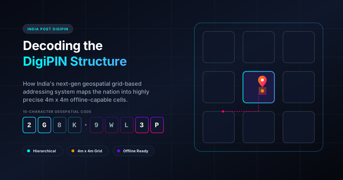
DigiPIN divides India into a massive matrix of approximately 4-meter by 4-meter (4m x 4m) squares. Whether it is a penthouse in Mumbai, a farm in Punjab, or an empty stretch of highway in Rajasthan, every single 16-square-meter space has its own permanent, unchangeable 10-character alphanumeric identifier.
The Anatomy of a DigiPIN Code
The magic of DigiPIN lies in its 10-character alphanumeric structure. It is designed to be highly readable, compact, and computationally efficient.
[ Region ] [ Sub-Region ] [ District ] ... [ Micro-Grid Cell ]
   Char 1      Char 2       Char 3            Char 4-10
1. Spatial Locality and Hierarchical Nesting
The code is structured hierarchically. The first character represents a very large geographical zone in India. The second character narrows it down to a sub-region, the third to a district-level area, and each subsequent character further subdivides the grid cell into smaller sectors.
By the time you reach the 10th character, the system has zoomed in from the size of the subcontinent down to a precise 4m x 4m square.
This hierarchical structure provides a crucial benefit known as spatial locality. Because nearby areas share the same parent grids, their DigiPIN codes will share the same prefix characters. For example, two adjacent houses on the same street might have codes that are identical for the first 8 or 9 characters, differing only in the final character. This makes sorting, routing, and database indexing incredibly fast for logistics systems.
2. The Alphanumeric Character Set
To prevent human error, DigiPIN does not use the entire 26-letter English alphabet and 10-digit numeric set. It carefully excludes characters that look alike or can be easily confused when written or spoken.
- Excluded Characters: Letters like
I(could be confused with1),O(confused with0),U(confused withV), and certain other ambiguous symbols are omitted. - Base-32/34 Encoding: By utilizing a modified base-32 or base-34 character set, the system maximizes the data density of each character while maintaining high human readability and error resilience.
If you want to see this technology in action, you can easily generate your own DigiPIN online using official utilities to pinpoint your exact doorstep.
The Math Behind the Grid: How Coordinates Become Codes
How does a GPS coordinate (Latitude and Longitude) transform into a neat, 10-character DigiPIN? The underlying technology relies on advanced geospatial indexing algorithms.
+-----------------------------------+
|             Level 1               |  <- Large Zone (Character 1)
|  +-----------------------------+  |
|  |           Level 2           |  |  <- Sub-Region (Character 2)
|  |  +-----------------------+  |  |
|  |  |        Level 10       |  |  |  <- 4m x 4m Doorstep Grid (Char 10)
|  |  |      [ DigiPIN ]      |  |  |
|  |  +-----------------------+  |  |
|  +-----------------------------+  |
+-----------------------------------+
Bounding Box and Partitioning
The system defines a bounding box that perfectly encloses the geographical boundaries of India.
- This bounding box is partitioned into a grid of major sectors (e.g., a 4x4 or 8x8 matrix).
- Each sector is assigned a specific character.
- When a coordinate falls into a sector, that sector’s character becomes the first character of the DigiPIN.
- That sector is then partitioned again into another grid. The sub-sector containing the coordinate yields the second character.
- This recursive partitioning continues down to 10 levels.
Because this is a purely mathematical conversion, no internet connection is required to translate a DigiPIN to latitude/longitude coordinates or vice versa. Any device running the DigiPIN algorithm offline can instantly decode a 10-character string into precise GPS coordinates.
PIN Code vs. DigiPIN: A Comparative Analysis
To understand why this is a revolutionary leap for Indian infrastructure, let us compare the traditional PIN code with the new DigiPIN system:
| Feature | Traditional PIN Code | DigiPIN |
|---|---|---|
| Format | 6-digit numeric (e.g., 110001) | 10-character alphanumeric |
| Precision | Broad area (covers several square kilometers) | Micro-grid (covers a 4m x 4m area) |
| Dynamic Updates | Requires manual boundary mapping | Purely mathematical, zero-maintenance grid |
| Offline Decoding | No (requires database lookups) | Yes (can be decoded via offline algorithms) |
| Last-Mile Accuracy | Low (requires local knowledge/landmarks) | Pinpoint (direct to the doorstep) |
Transforming the Indian Logistics and Courier Ecosystem
For logistics, e-commerce, and courier companies operating in India, the “last-mile delivery” challenge accounts for up to 30% of total shipping costs. Address ambiguity causes delayed deliveries, high fuel consumption, and repetitive phone calls from delivery agents asking, “Landmark kya hai?” (What is the landmark?).
Traditional Address -> [Vague Landmark] -> [Multiple Phone Calls] -> [Delayed Delivery]
DigiPIN Address     -> [4x4m Grid Code] -> [Direct Route Navigation] -> [First-Time Success]
1. Zero-Friction Route Optimization
By converting delivery addresses into DigiPINs, courier companies can feed pure mathematical coordinates directly into vehicle routing engines. Algorithms can calculate the absolute shortest path between multiple 4m x 4m cells without needing to parse complex text addresses.
2. Drone and Autonomous Deliveries
As India moves toward drone delivery ecosystems and autonomous logistics, text-based addresses are obsolete. Drones require exact coordinate inputs to land safely. A DigiPIN provides the perfect, standardized, machine-readable destination format for autonomous flight paths.
3. Disaster Management and Governance
For government agencies, DigiPIN is a lifesaver during emergencies. In floods or earthquakes, traditional landmarks may be destroyed. Because DigiPIN grids are anchored to mathematical coordinates on the earth, emergency responders can locate affected structures even if the entire local landscape has changed.
Conclusion: The Backbone of Digital India’s Spatial Web
The DigiPIN is more than just an upgrade to the postal system; it is a fundamental pillar of India’s digital public infrastructure (DPI). By translating the complex physical landscape of India into a structured, mathematical, and highly optimized 10-character grid, DigiPIN bridges the gap between physical locations and digital systems.
Whether you are a logistics provider looking to slash delivery times, a government agency planning urban infrastructure, or an everyday user tired of explaining your home address, understanding the power of the DigiPIN grid is your first step into the future of spatial navigation.